[Leicester North]
[Abbey Lane Area]
[North Viaduct]
[Leicester Central]
[Braunstone Gate]
[Goods Yard]
[Aylestone]
[Bridging the Gap]
[Notes for Visitors]
[Old Photographs]
[Archive]
[Links]
Archive Section
| [Loughborough & Sheepshed Railway] [Signal Box Diagrams] [Royal Agricultural Show at Leicester, 1924] [Holiday Trains at Leicester Central, 1963] [Main Line Preservation Group] |
Loughborough and Sheepshed [sic] Railway Maps
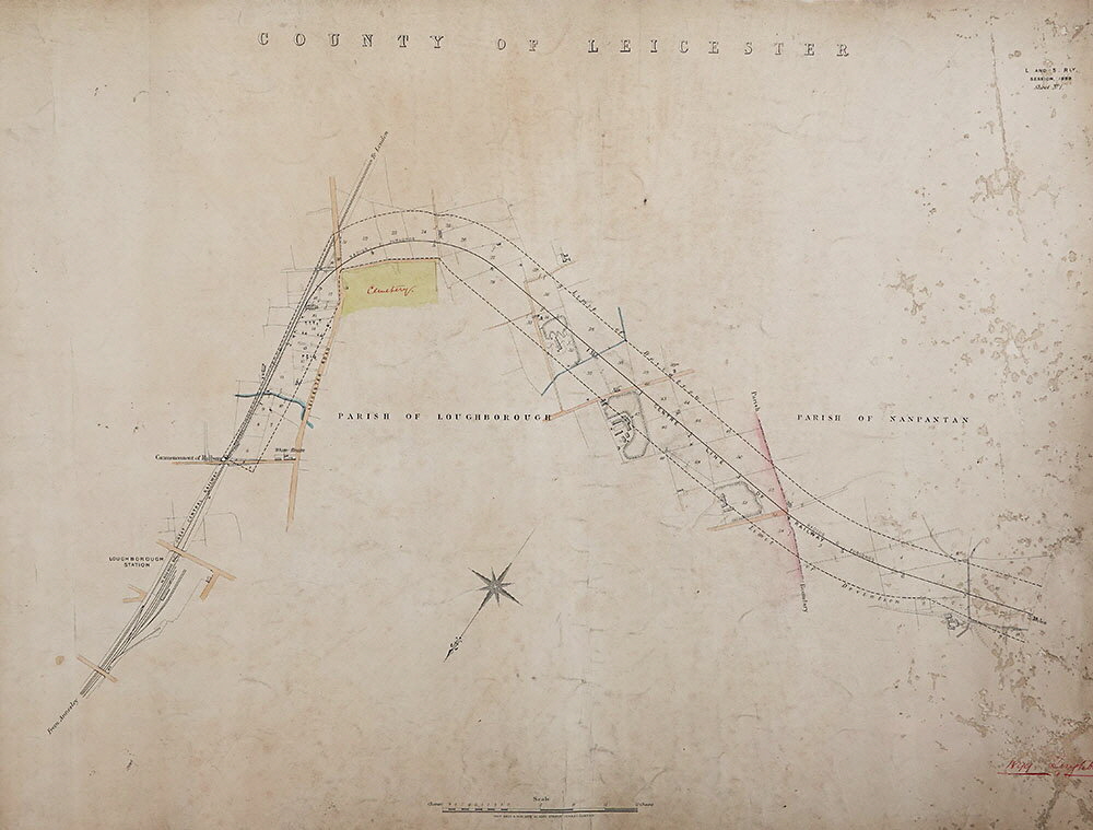
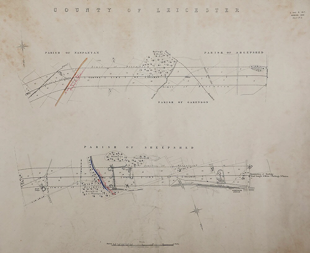
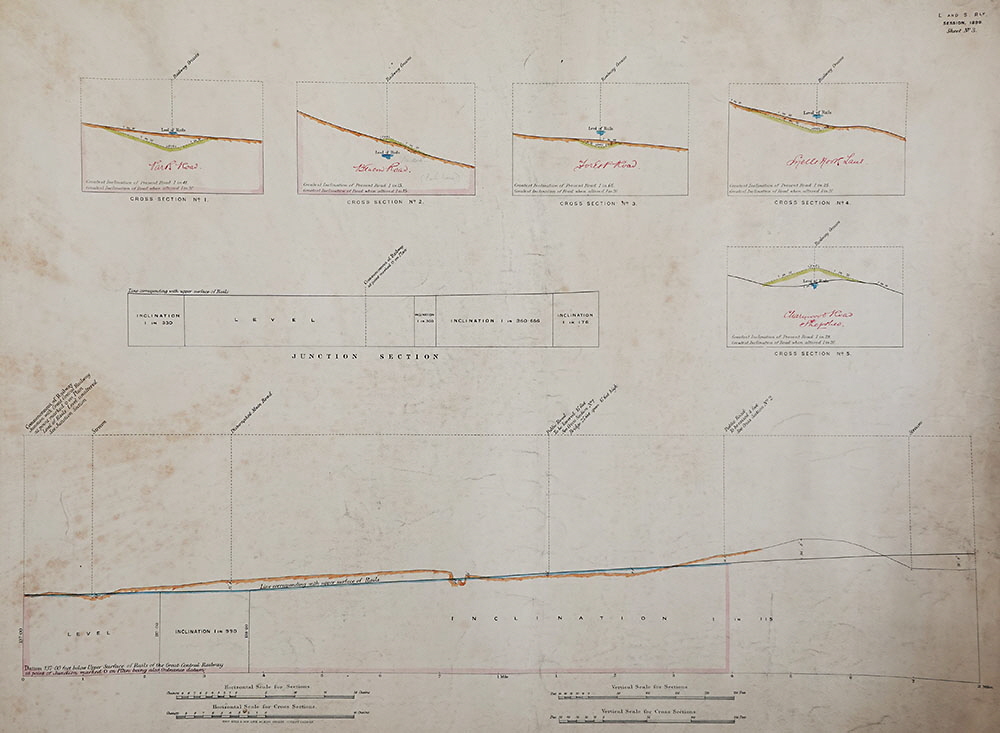
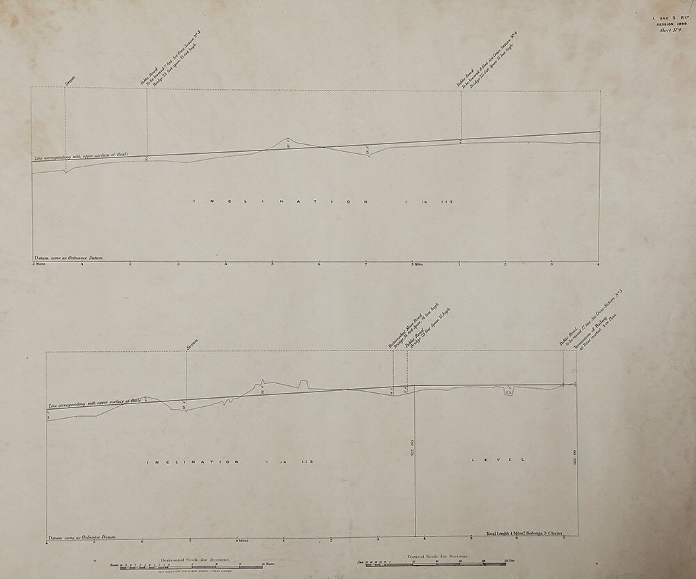
In this section are scans of four maps, 640mm x 560mm, of a proposed 4 miles branch line from Loughborough Central Station to the nearby village of Sheepshed [sic] (an old version of the modern name of Shepshed). The maps were produced for putting before parliament with the private ‘Loughborough And Sheepshed Railway Bill’. Hansard of Tuesday 6 June 1899 reported that the bill had received the Royal Assent, but there is no record of any building work for this railway being carried out and the consent was apparently allowed to lapse.
This was one of several abortive plans to link Shepshed with the Great Central Railway main line, both to the north and south, at Loughborough around this time.
A very interesting report which appeared in the Nottingham Journal of Tuesday 5th December 1905 (shown here via the Facebook group ‘Charnwood Forest Railway’) described that the railway in the plans shown below had been promoted by a private syndicate, but that the London and North Western Railway was now interested in carrying forward a modified plan, additionally with a connection to the Charnwood Forest Railway near to Shepshed:
“LOUGHBOROUGH RAILWAY PROPOSAL NEW LINE FOR SHEPSHED
Plan have now been deposited for proposed new line railway between Loughborough and Shepshed, promoted by the London and North Western
Railway Co., and joining the Great Central main line. Measuring in all nearly six miles long, the new line will branch off the Leicester side of the Loughborough Great Central station, some 400 yards up, near to Beeches
Lane. From this point it runs alongside the trunk line as far as Shelthorpe Cottage, whence it turns sharply to the west, cuts across the Leicester main road, and proceeds round the top of the cemetery. Passing through
the old brickyard on Ling Lane, the new line skirts Messrs. Tucker’s brick works to the south, and crosses Beacon Road, the borough boundary, near the entrance to the fever hospital. Next comes the Forest Road, which
probably will be spanned by a bridge somewhere near Wally’s Farm, and then follows Burleigh Wood, whilst Snell’s Nook is passed through in the hollow. From here the line, taking a course through Hurst farm, passes
close past the quarries, and crossing the Ashby Road near the four-lane ends, passes by Messrs. Gibbs’ brickworks, connecting with the Charnwood Forest railway past Tickhill Lane, behind the White Horse Wood. The
proposed railway is almost identical with the one for which powers were obtained in 1899 by a private syndicate of local gentlemen. There was that time a suggestion made on behalf of the Loughborough Corporation that the two
existing lines should be linked by making a short length of railway through the borough, and extending from the present Derby Road station to the Great Central Railway line, which would be joined somewhere near the Nottingham
Road. This proposal was considered, and plan was drawn by the borough surveyor, showing the route suggested, but it did not commend itself to the promoters. Now that the London and North-Western Railway Co. have taken
the matter in hand, it is hoped that this much-needed line of communication will soon become accomplished fact.”
Apparently the act of parliament for building the railway shown in the plans below was allowed to lapse. Perhaps it was realised that the economics of the branch would be poor. Note that in 1896 the Light Railways Act had become law and under that act’s regulations the ‘Loughborough and District Light Railways’ bill was put before parliament in 1899 to build a light railway/tramway along the roads from Hathern to Loughborough and on to Mountsorrel. This would have demonstrated that there was a cheaper form of competition that could produce a route from Loughborough to Shepshed, though that light railway also was never built. The London and North Western Railway also lost interest in the modified plan mentioned in the article above.
‘Loughborough and Sheepshed Railway’ map 1 - Click here for a high-definition image.
‘Loughborough and Sheepshed Railway’ map 2 - Click here for a high-definition image.
‘Loughborough and Sheepshed Railway’ map 3 - Click here for a high-definition image.
‘Loughborough and Sheepshed Railway’ map 4 - Click here for a high-definition image.
Archive Section
| [Loughborough & Sheepshed Railway] [Signal Box Diagrams] [Royal Agricultural Show at Leicester, 1924] [Holiday Trains at Leicester Central, 1963] [Main Line Preservation Group] |
[Leicester North]
[Abbey Lane Area]
[North Viaduct]
[Leicester Central]
[Braunstone Gate]
[Goods Yard]
[Aylestone]
[Bridging the Gap]
[Notes for Visitors]
[Old Photographs]
[Archive]
[Links]
© 2001-2026 Text and photographs copyright Nigel Tout, unless otherwise indicated.


