[Leicester North]
[Abbey Lane Area]
[North Viaduct]
[Leicester Central]
[Braunstone Gate]
[Goods Yard]
[Aylestone]
[Bridging the Gap]
[Notes for Visitors]
[Old Photographs]
[Archive]
[Links]
This section covers the line from Leicester North station southwards to Beaumont Leys Lane.
Click here for a map of this area from Bing
Notes on using the Bing Map
The
map linked to is the Ordnance Survey map.
To see an aerial photograph of the area covered by the map click on the tab labelled “Ordnance Survey” near top right of the screen and select ‘Aerial’
from the drop-down list.
When finished with the map click on the browser ‘Back’ button till you return here.
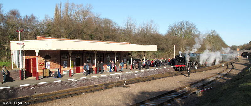
The Great Central Railway’s new Leicester North Station with Britannia 4-6-2 70013 “Oliver Cromwell” having just arrived from Loughborough during the Winter Steam Gala in
2010.
The island platform of the original Belgrave and Birstall station was located to the right of the train, where the run-round loop is, and was accessed from stairs leading down from the bridge in the background.
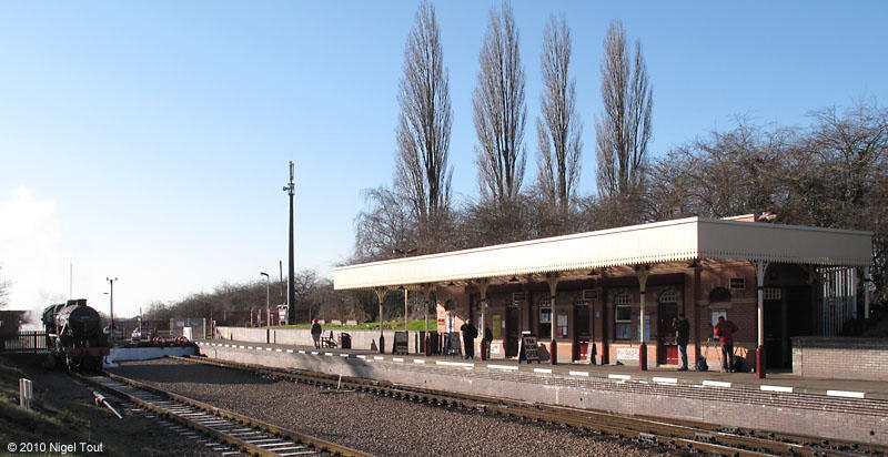
Leicester North Station with “Black 5” 5-MT 4-6-0 45231 “The Sherwood Forester” awaiting its next turn of duty during the Winter Steam Gala in
2010.
Originally the tracks continued south, beyond the buffer stops to Leicester Central station and on to London Marylebone station.
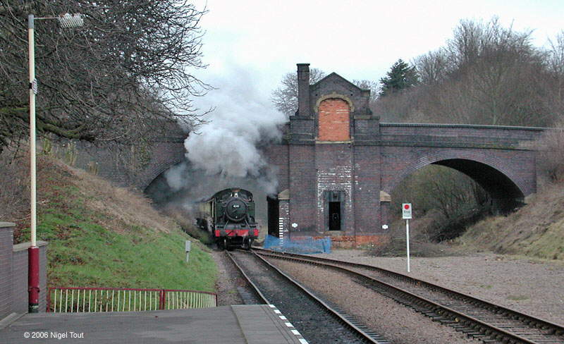
A train from Loughborough hauled by ex-GWR 2-6-2T 4141 passes under Station Road Birstall, with the remains of the entrance to the demolished Belgrave & Birstall station, as it approaches Leicester North station.
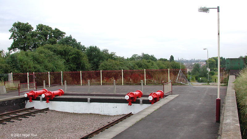
Looking south over the buffer stops of Leicester North station towards the approach road. The track originally carried on here leading on to an embankment.
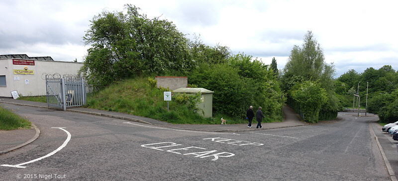
Looking south down the approach road to Leicester North GCR station, 50 yards south of the photograph above. This is a new road, called The Sidings, with a junction from the Leicester Outer Ring Road, and was constructed after removal of the railway embankment. The entrance on the left leads to the Greenacres site, with the “Platform” restaurant, where the station master’s house used to be. The footpath leading off at centre left to a bridge over the Ring Road follows the route of the original road to the house.
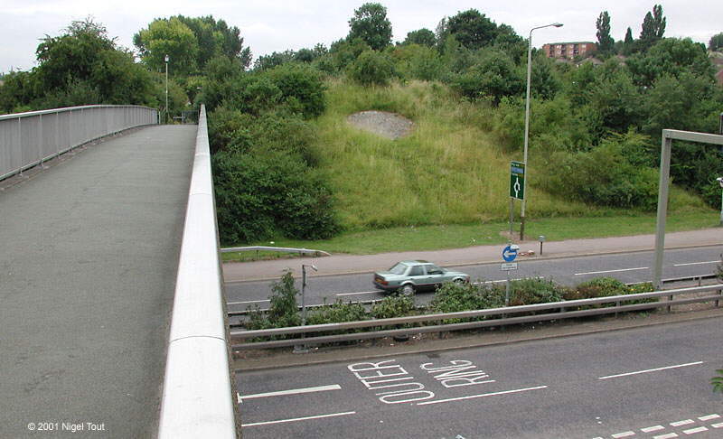
Following the footpath across the bridge over the Outer Ring Road, looking south. The embankment carrying the railway was parallel to this bridge and is marked by
the lighter green area on the far side of the road, with a circular pattern of stone blocks. Note that in 2015 the pattern of stone blocks was hidden by the growing vegetation.
The junction of the approach road to
Leicester North station can just be seen at bottom right.
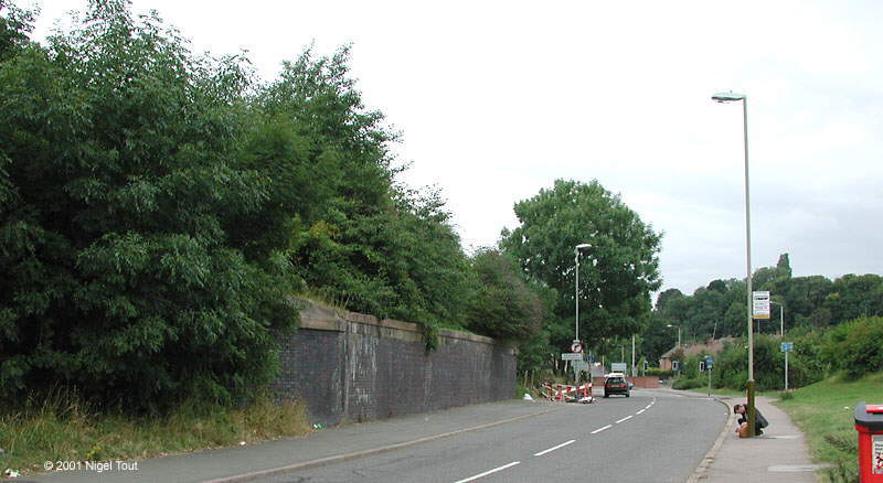
The only remains of the brick bridge across Thurcaston road, looking North West towards Thurcaston (this road is now cut by the new course of the Outer Ring road).
The
footpath from the footbridge shown above comes down from the right.
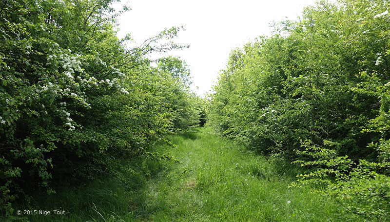
The track bed at the top of the embankment to the south of Thurcaston road, looking south. The embankment is intact for about half a mile to beyond Beaumont Leys
Lane but is very overgrown in places.
Although not apparent from the photograph this part of the route passes through a high-density housing estate. The houses and flats are well below the high embankment and are obscured
by the bushes.
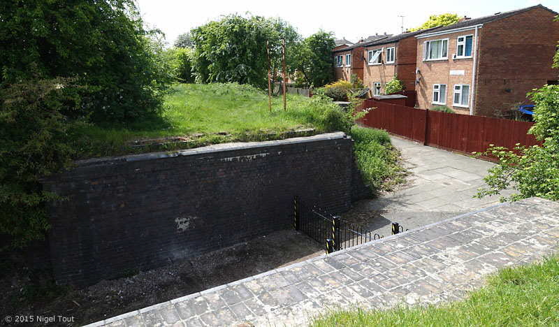
The remains of the brick bridge across Millbrook Walk, which links Millbrook Close and Greystoke Road, looking south.
Planning applications have been submitted to redevelop the trackbed around here with housing, a linear park, and footpath/cycleway, but have been rejected.
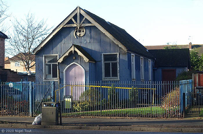
On the west side of Abbey Lane, a short distance from the route of the GCR, between Thurcaston Road and Beaumont Leys Lane is this distinctive building. It appears on the 25-inch Ordnance Survey map revised in 1901 where it is marked ‘Mission Room’. This is a very similar type of structure to some of the Navvy Mission Rooms photographed by S.W.A. Newton and which were used by the navvies during the construction of the Great Central Railway in the 1890s, for example see www.railwayarchive.org.uk/getobject?rnum=L1155. Although this example may not have been built specifically for use by railway navvies this is an interesting example of the type of mission hall that was used by them.
In November 2022 the Leicester Mercury reported that the building has been refurbished and gives the information that this was a daughter chapel of St. Peter’s parish church (in Belgrave) and was built the year before work started on the building of the Great Central Railway. The chapel was bought by the ‘Community of Christ’ in 1977 and is a ‘Locally Listed Building’.
In August 2024 the ‘Story of Leicester’ Facebook page showed an old photograph from the 1920s (when the building appears to have two small ‘bell’ towers) with the information: “Erected in 1894 by the Church of England, it was initially called the Church of the Good Shepherd and served the working-class communities of the Parish of St Peter’s, Belgrave. Unusually for a church, it is made from sheet iron . This type of prefabricated building, commonly nicknamed a “tin tabernacle”, was once common across Britain. They were cheaper and quicker to construct than stone or brick churches, and were usually painted white, green or blue to help prevent rust. The Little Blue Church is the only such “tin tabernacle” remaining as a place of worship in Leicester. One other survives in Evington, but is disused.”
[Leicester North]
[Abbey Lane Area]
[North Viaduct]
[Leicester Central]
[Braunstone Gate]
[Goods Yard]
[Aylestone]
[Bridging the Gap]
[Notes for Visitors]
[Old Photographs]
[Archive]
[Links]
© 2001-2026 Text and photographs copyright Nigel Tout, unless otherwise indicated.